Canyons and Twisties - From Mescalero to Timberon, New Mexico
Distance: 56.9 Km / 35.5 Mi Duration: 00:46:52
Riding in New Mexico from Mescalero to Timberon
This motorcycle route is all about uninhibited enjoyment on twisty mountain roads. Sweeping turns take you past farms and ranches, through canyons and the Lincoln National Forest. The ride is 66 miles (106.2 km), and can be completed in less than 2 hours.
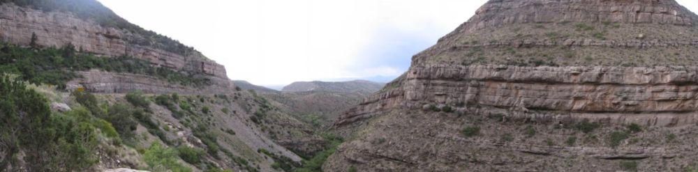
Canyons in New Mexico
Begin in Mescalero, New Mexico
It's a small town of 1,200 people located 87 mi (140 km) west of Roswell. The town was previously named Blazer's Mill, the location of the famous gunfight involving Billy The Kid during the Lincoln County War. For more history on the Battle of Blazer's Mill see: http://en.wikipedia.org/wiki/Gunfight_of_Blazer%27s_Mills
From Mescalero go to Cloudcroft
Go Northeast on US-70 E for 4.5 mi (7.25 km), then turn right onto New Mexico Route 244 (NM-244). Here you will head Southeast for 15.5 mi (24.9 km). The motorcycle road then takes a sharp turn to the southwest and continues on for 13.5 mi (21.7 km).
Turn right at US-82 W and in 1.2 mi (1.9 km) you will reach the town of Cloudcroft. NM-244 is a curvy, single lane road through forest. The elevation ranges from 6,560 ft (2,000 m) to 8,659 ft (2,639 m).
Arrive in Cloudcroft
A town of 750, located 20 mi (32.2 km) east of Alamogordo on US-82, incidentally another amazing motorcycle road worth checking out. The little town holds the title of the 4th highest city in the United States, boasting an elevation of 8,659 ft (2,639 m).
Located in an arid region, temperatures range from 73f (23c) in summer to 41f (5c) in winter. Cloudcroft was named by 'Fodors' in 2002 as the third "Most Overlooked and Underrated Destination Spot”. Cloudcroft also offers dual sport opportunities.
There are countless dirt and gravel roads in and around the entire area to satisfy the off-road adventure rider. Make sure you gas up at the last station in Cloudcroft before leaving for Timberon.
For information on what to see, where to eat and sleep in Cloudcroft see: http://cloudcroft.com/ For dirt and gravel motorbike roads in Cloudcroft see: http://www.twtex.com/forums/showthread.php?t=49082
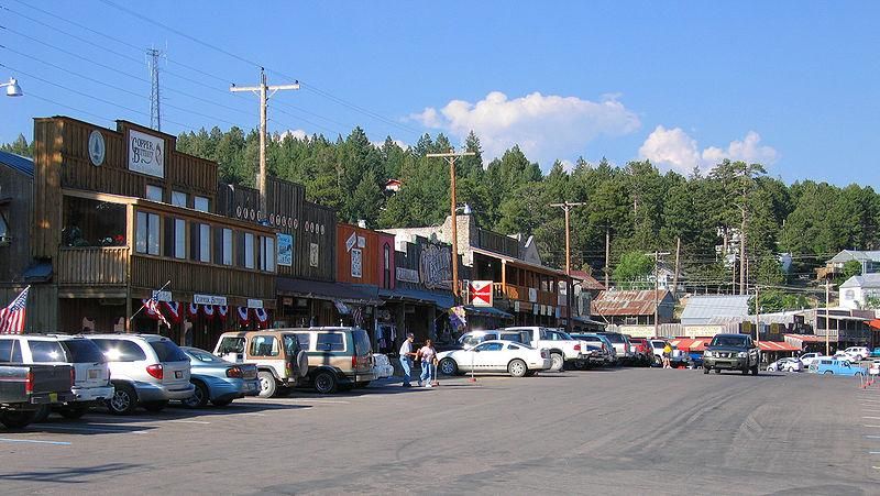
Cloudcroft, New Mexico
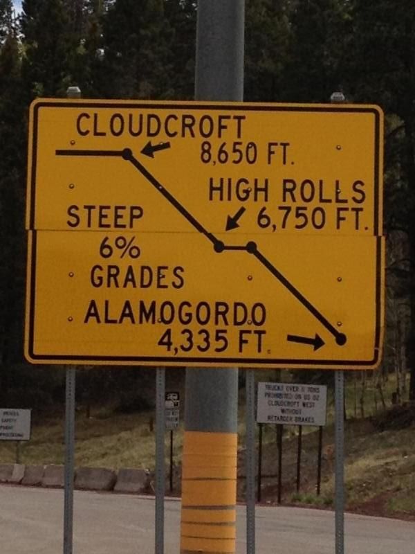
Cloudcroft, New Mexico - Grade Sign
Twisty roads and canyons in and around Cloudcroft, New Mexico
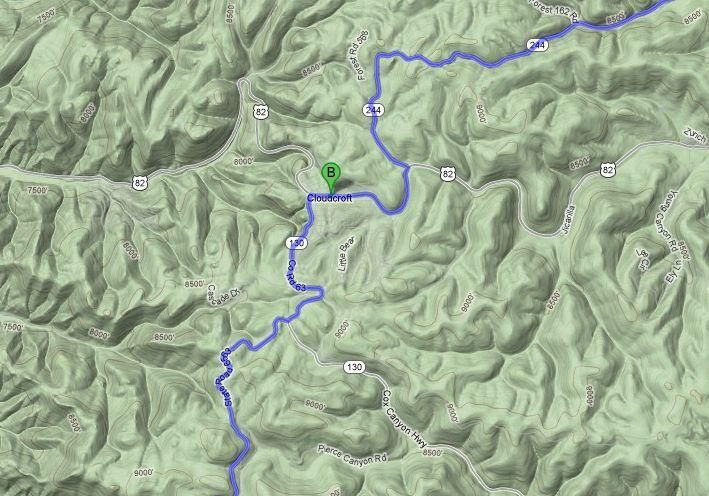
Leaving Cloudcroft go to Timberon
Go on Cox Canyon Highway (NM-130) south for 2 mi (3.2 km). Turn right and continue south on Sunspot Highway (State Road 6563) for 14 mi (22.5 km). The National Solar Observatory is located here and is open to visitors.
The road then becomes Sacramento Canyon Highway (Forest Road 537), where you will travel south for 13 mi (20.9 km) to Timberon. The road from Cloudcroft to Timberon is full of twisties as you ride through the Canyons in the Lincoln National Forest. The terrain descends from an elevation of 9,515 ft (2,900 m), to 6,890 ft (2,100 m).
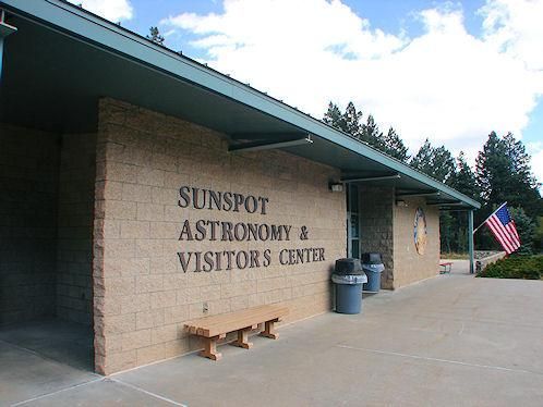
Sunspot Observatory, New Mexico
There is not much to see in TimberonÂ
Other than a few houses, a lot of forest, and a 9-Hole golf course, but the ride to get there is fun, providing technical corners, and hills to rival a roller coaster.
This route offers majestic and breathtaking views of mountains, canyons, and forests. The once overlooked beauty of this area is starting to get noticed, so take a look for yourself then tell us what you think.
Enjoy the ride! EatSleepRIDE.