Col de L'Iseran: Saint Bourg Maurice to Lanslebourg-Mont-Cenis, France
Distance: 61.6 Km / 38.4 Mi Duration: 02:15:02
Riding Col de L'Iseran the highest paved pass in the Alps is amazing!
Ride the highest paved Alpine Pass on the Alps. The Col de l'Iseran pronounced cole-d-liz-err-un connects Saint Bourg Maurice to Lanslebourg-Mont-Cenis using the highway D902. The route runs 82.4 km (51.2 mi) and can be completed in less than 2 hours.
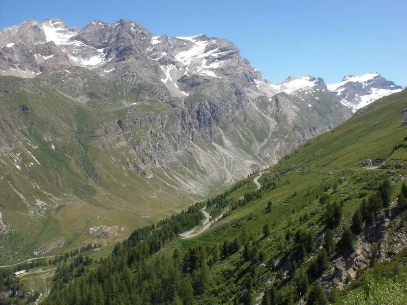
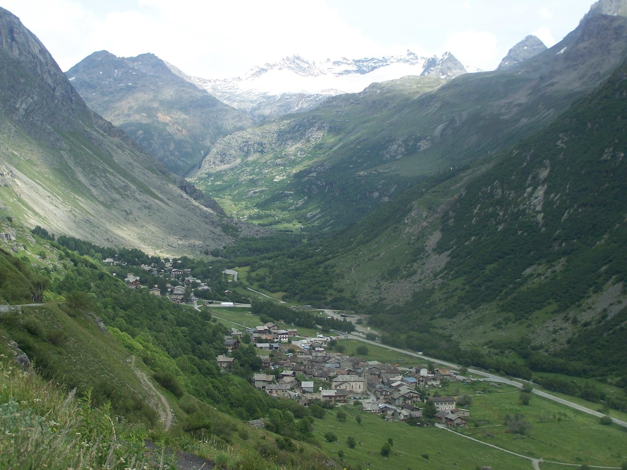
Col de l'Iseran Scenery
The Col de L'Iseran
An alpine mountain pass on the D902, located in Southwest France. It's the highest paved mountain pass in the Alps at 2,770 metres (9,090 ft). The road has several few hairpins and many twisties. The roads go through tunnels and along Lake Tignes as you climb to the peak.
L'Iseran was a featured road in the Tour de France, 7 times in total with the first in 1938 and most recently in 2007. The pass is only accessible in summer by road and via ski lift in winter at Val-d'Isère and Tignes, both being popular Ski resorts.
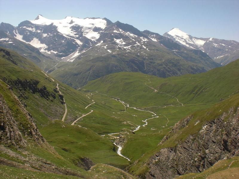
Twisty roads at Col de l'Iseran
Photo credits: User pingvin on alpineroads.com
Start this great motorcycle road in Bourg-Saint-Maurice France
A small town of 8,000 located in Eastern France near the border to Italy. The town is part of the Paradiski ski-area in the Tarentaise Valley http://en.paradiski.com/.During the summer months the town is a haven for water-sports, paragliding, hiking and biking.
Many motorcycle riders visit in summer to ride onto the D1090-SS26, which has 40 hairpin turns. For more information on what to see, where to eat, and where to sleep see: http://en.bourgsaintmaurice.com/.
From Bourg Saint-Maurice to Val-d'Isere
Ride on the D902 Southeast for 31.8 km (19.8 mi). Here you will pass by the town of Seez and the start of the Col du Petit Saint Bernard Continuing Southeast pass through the town of Sainte-Foy- Tarentaise and along Lac du Chevril then continue riding Southbound to reach Val-s'Isere.
The road here rises in elevation from, 800m (2,624.7 ft) in Bourg Saint- Maurice to 1,800 m (5,905.5 ft) in Val-d'Isere.
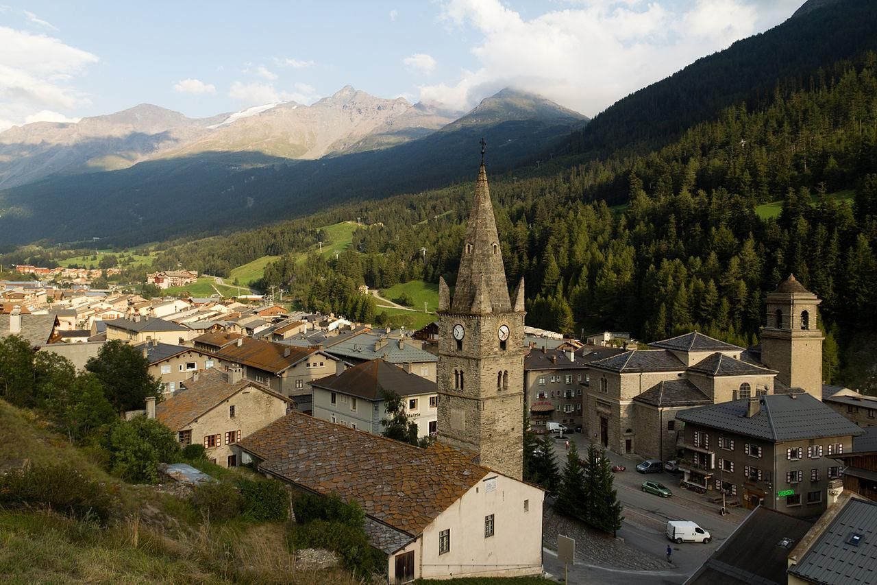
Val-d'Isere is a town of 1,700 people located 5km from the Italian border in Southeastern France. Val-d'Isere is a popular ski town, where it regularly hosts World Cup alpine events. It also hosted all the alpine events for the 1992 Winter Olympics.Also the town was the start of the Tour de France Stage 9 in 2007. For more information on what to see, where to eat and sleep in Val-d'Isere see: www.valdisere.com
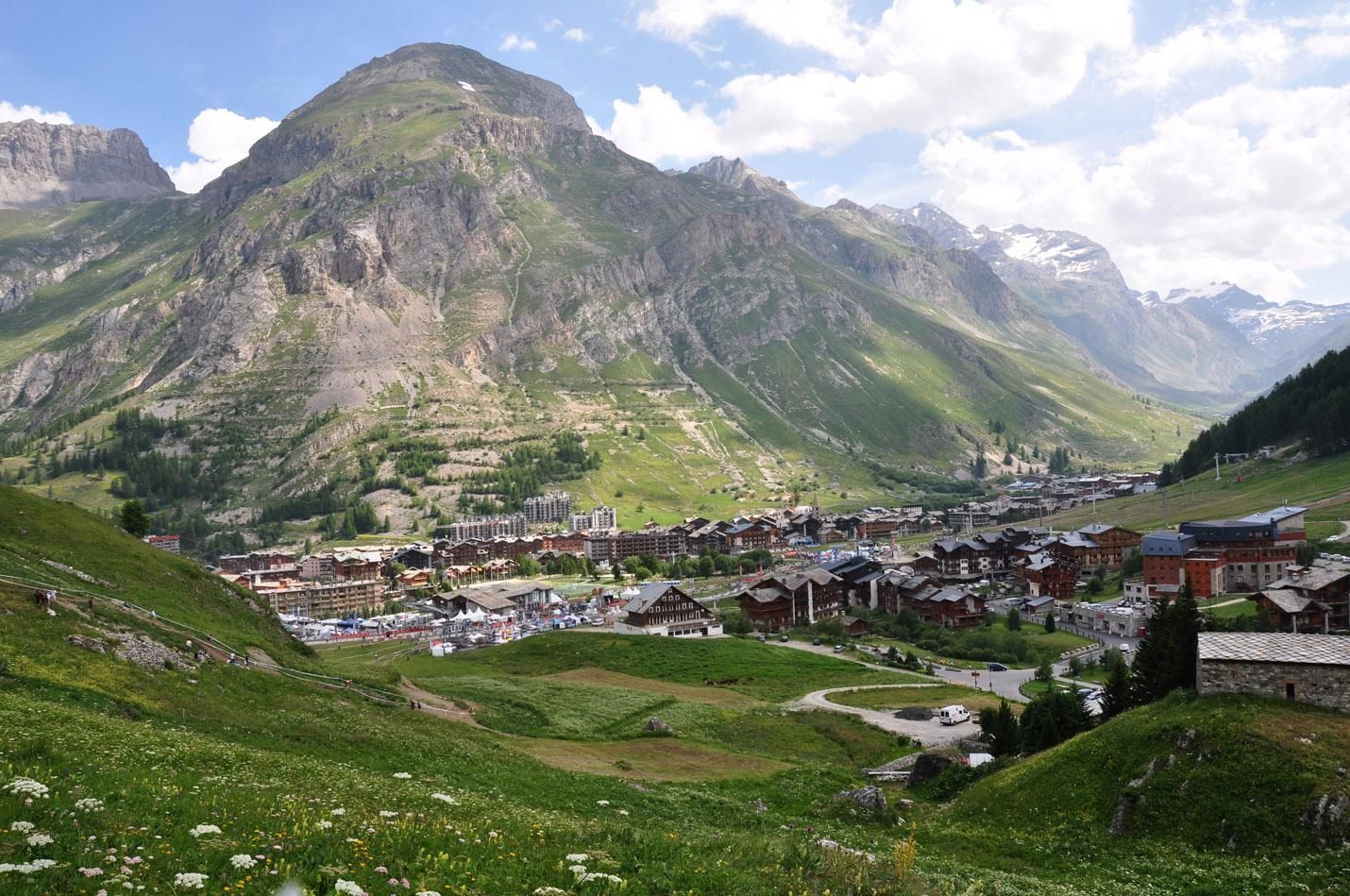
Val d'Isère, France
From Val-d'Isere to Bonneval-sur-Arc
Continue on the D902 for 29.7 km (18.5 mi). The road here gets to be very twisty with several hairpins along with many tunnels. The elevation rises from 1800 to 2770m (5,905.5 -9,088 ft). The highest point is located at the Refuge du Col du Palet, a building where you can stop in for some eats and photo opportunities.
Continue Southbound on the D902 for 13.5 km (8.4 mi) to reach Bonneval-sur- Arc. The descent down from the Peak to Bonneval-sur-Arc dips in elevation from 2770 to 1800 m (9,088 - 5,905.5 ft). Remember that descending is actually a greater test of rider skill than climbing, so be ready!
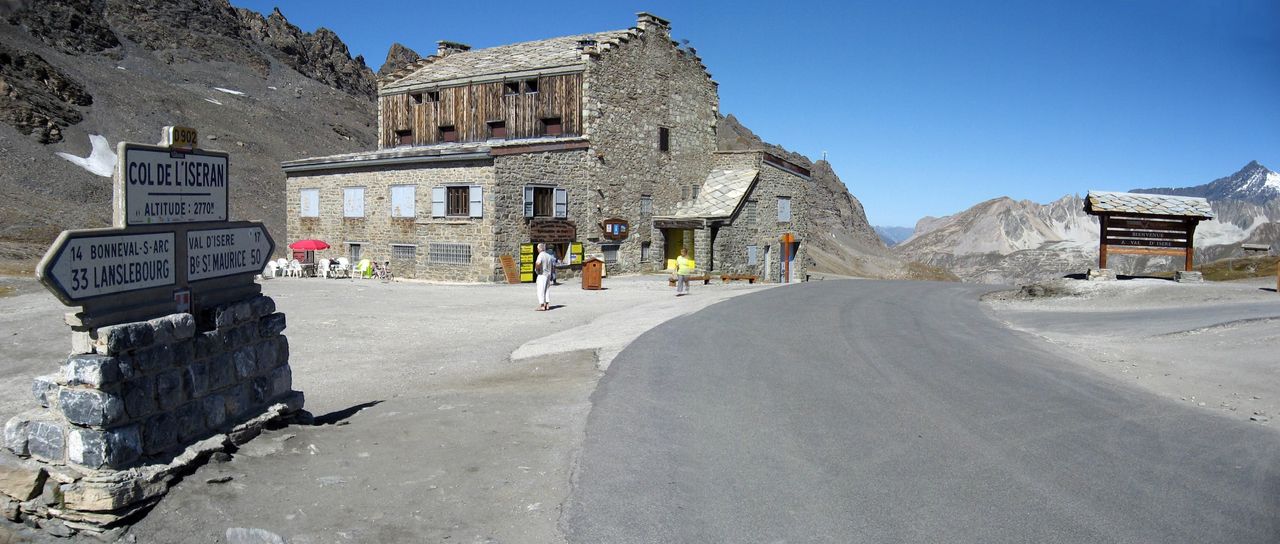
Col de l'Iséran summit sign
Photo credit:www.ski-epic.com
Bonneval-sur-Arc
A town of just 250 people, located South of the Col du l'Iseran. For more information on what to see, where to eat and sleep in Bonneval-sur-Arc see: www.bonneval-sur-arc.com
Bonneval-sur-Arc, France
From Bonneval-sur-Arc to Lanslebourg-Mont Cenis
Continue Southbound for 19.5 km (12.1 mi). Bonneval to Lanslebourg elevation drops from 1800 down to 1400 m (5,905.5 - 4,593.2ft).
End the ride in Lanslebourg-Mont-Cenis a town of 600 people located in Southern France only 95km (59 mi) West of Torino, Italy. The town is a hotspot for visitors looking to start on the South end of the Col du l'Iseran. For more information on what to see, where to eat and sleep in Lanslebourg see: www.lanslebourg-montcenis.fr
Lanslebourg - Mont Cenis, France
Riding the D902
It's the tallest passes of all the Alps, is a thrill to say the least. The journey takes place on 82.4 km (51.2 mi) of Alpine asphalt of exciting roads, and great scenic views. The ascending and descending of this gradient filled route is nothing a trust motorcycle can't handle, but will test a rider thoroughly.
Experienced riders will find themselves flying by slower moving vehicles, including bicycles, as everyone works their way to the peak and then back down again enjoying the many twisties, tunnels, and views along the way. This is definitely a ride you'll want to try in the opposite direction, enjoy the ride. Eat Sleep RIDE.
Motorbike Routes - Col de l'Iseran
Check out this other Alpine pass that starts in Bourg Saint Maurice:
You must be logged in to comment
Login now