Ride home
Distance: 267.3 Km / 166.5 Mi Duration: 03:07:06
The app didn't capture my ride yesterday which is really unfortunate because it was the most eventful day of the trip. Google maps almost killed me (again) by leading me up a mountain pass that turned out to be closed. That wouldn't have been so bad except that it was in the middle of nowhere and I was almost out of gas. Literally the last 1000 meters of the pass where covered in four feet of snow. I actually walked to the top and took a picture of Mt Shasta (see below). I ended up coasting back down the hill in neutral with the engine off (probably five miles or more). This road was nearly abandoned as one could imagine. I then heading toward the nearest town. Rode to the top of the next pass and ...ahem...coasted with the engine off down that one also except this time it was California Route 3 toward Callahan. There isn't a gas station there either as luck would have it so I limped another 12 or so miles to Etna to the nearest gas station. There I fueled up and continued on Rt 3 to I-5. Took I-5 south to Grenada and then cut over to 97 north. Took 97 all the way to Bend OR. I promise that I did not magically teleport from Eureka CA to Bend OR. See the pictures to prove it. All on the pictures from this post were actually taken yesterday.
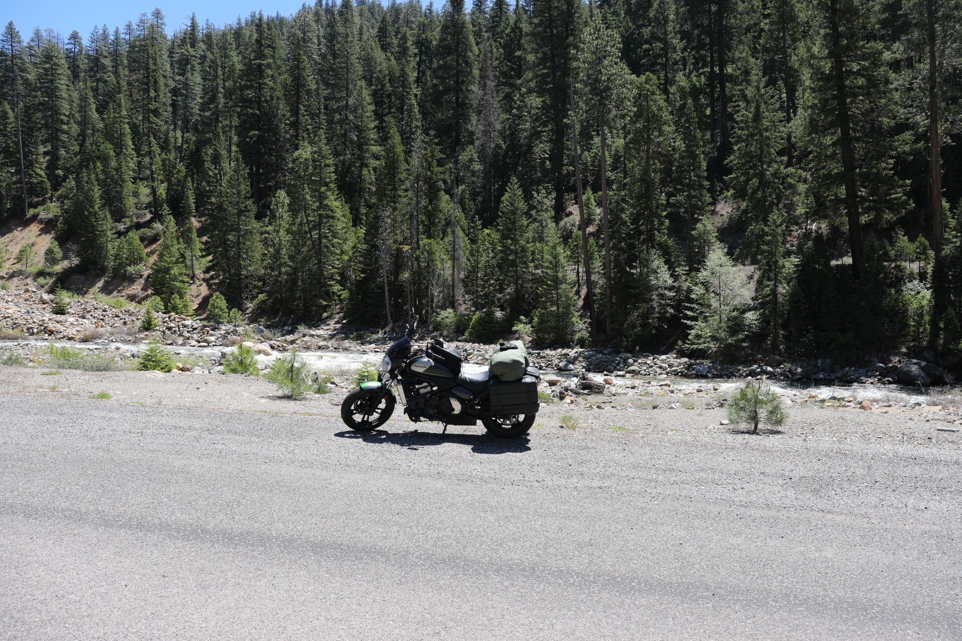
This is the mountain "road". At this point I thought the story was going to be the horrible road Google Maps took me down.
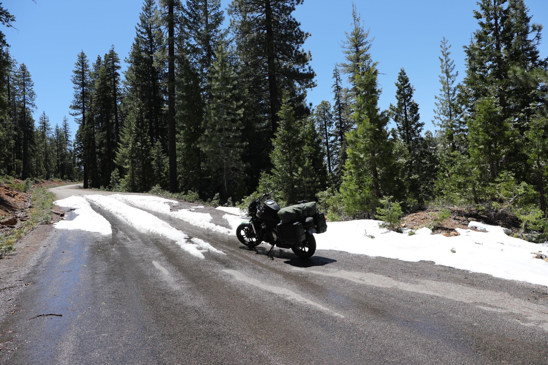
Yup I rode through the snow. It came over the pegs. I still thought that the worst was over at this point.
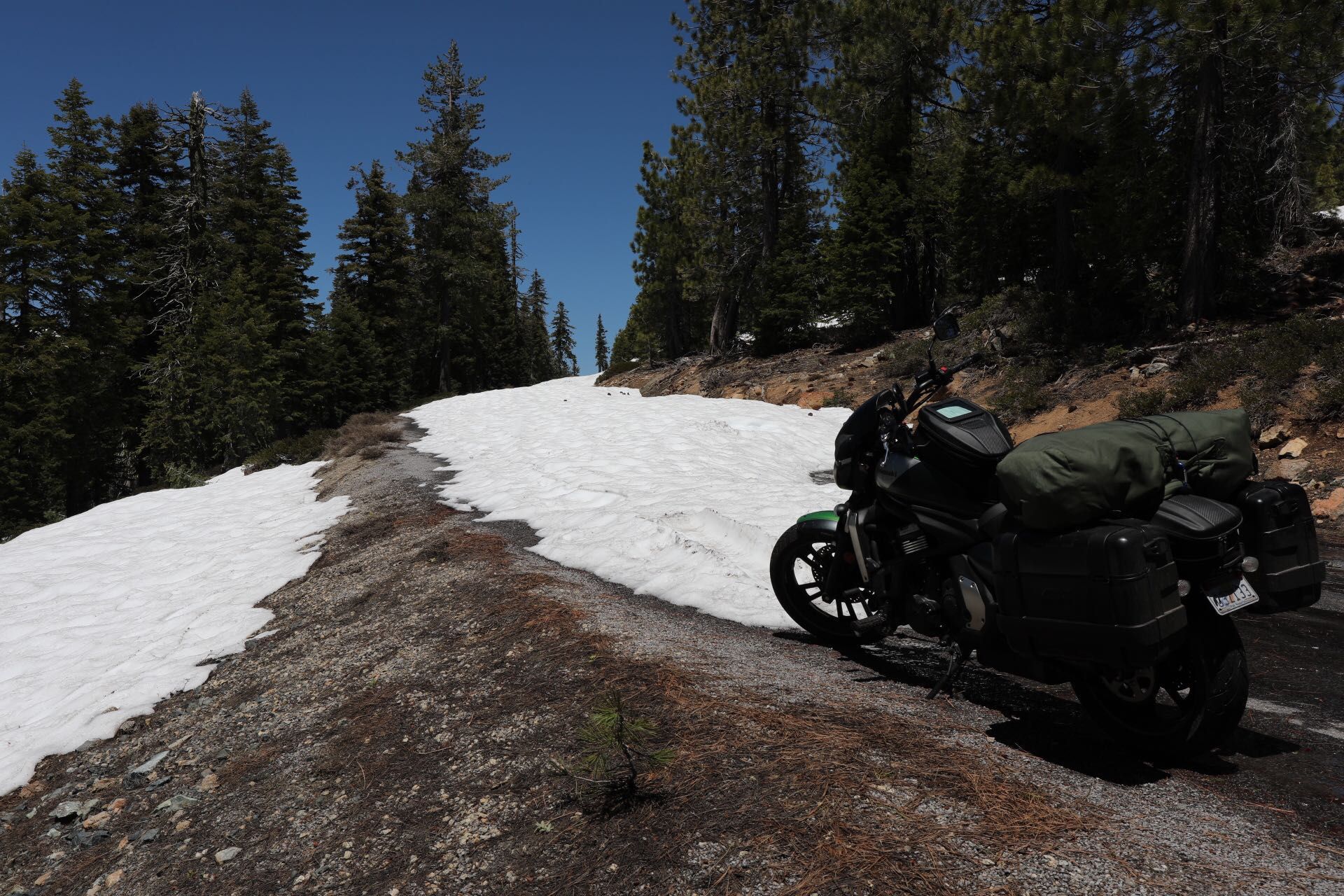
End of the road. I could ride no further but walked to the top to take the next picture.
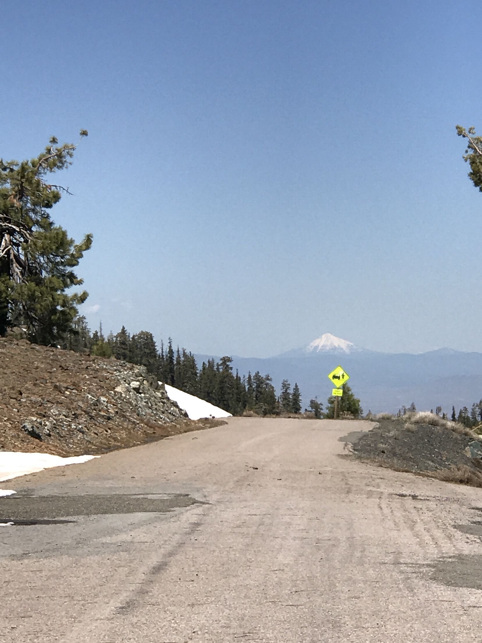
This is Shasta from the top of the impassable pass.
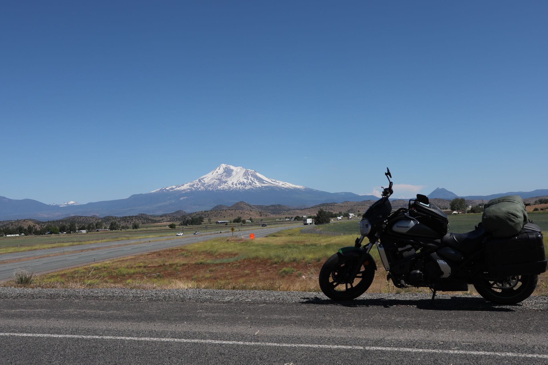
And this is Shasta from an overpass after I had coasted down two hills and rode on fumes to get fuel. From here it was mostly smooth riding to Bend.
You must be logged in to comment
Login now