Volcanoes & Dirt Roads
Izta-Popo National Park - August 31-Sept 2, 2011
Posted by Sandra
Okay, the thing about our trip is that we are planning it as we go. The good in this is, we are free to stay as long as we want in a place we enjoy or, we can hit the road if we feel like it. The bad in this is that we usually spend 3 hours or so every other day researching and route planning for the next stop.
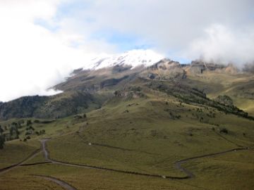
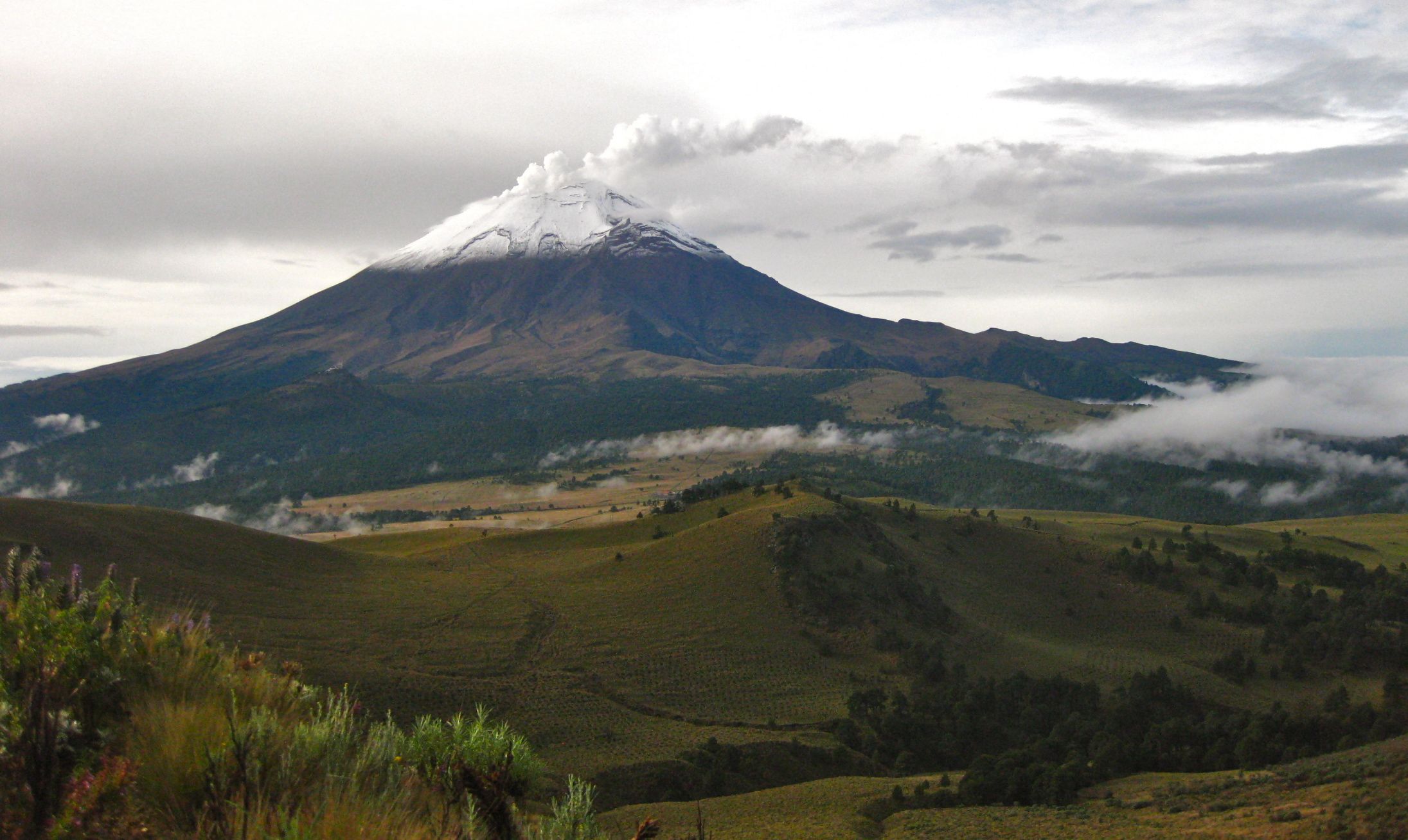
We have spent a great deal of time exploring Mexico's Altiplano region. It is full of history - indigenous, colonial, revolutionary, and political - the area is up high, away from the August heat, and the riding throught the mountains is absolutely fantastic! So, when we were waiting out one of the daily, monsoon-like rainshowers in the very pretty town of Tlaxcala, I was thrilled when I came upon Parque Nacional Izto-Popo, a national park that boasts the 2nd & 3rd highest peaks in the country;** Iztaccihuatl **(the sleeping lady), a climbable, dormant volcano at 5,230m (17,159ft), and Popocatepetl (the smoking man) at 5,426m (17,802ft), which is not climbable, due to the fact it is currently active.

Iztaccíhuatl from Tlaxcala
We love the mountains & we love camping, so it immediately became part of our agenda. According to the map and the sparse information I found on the internet, in just 1 hour's ride we would be in contact with the Park office in the town of Amecameca where we would pay for park admittance and for a 2 night's stay at an alpine hut located between the two volcanoes.
Contrary to our previous posts about the northern Mexican highways, we have found that the secondary & tertiary highways in the central-south may or may not be well signed - it is basically a crap shoot. We think it is due to so much growth in the area that our paper map doesn't always match the roads, and the roads do not always match Google Maps, and rarely does anything in Mexico match our GPS. The only thing to be sure is that our routes are never assured. Another good reason for being a flexible traveler!
Needless to say, we missed the unmarked turn to Amecameca that would have shortened the trip by one hour - but this was no problem… we were happy to ride and we had full tanks of gas. We didn't really notice that the toll-free route we chose would take us through insane traffic on the edges of Mexico City. We bobbed from lane to lane finding our way through the thick diesel fumes trapped by the overpasses above, and squeezing between busses and semi trucks. We fit through some very tight spots, many, a little _too_close for comfort. It was kind of like a live action version of the video game,_Frogger, _but with the added feature of banana salespeople and fire breathers located at each stop light. It was a miracle that we happened to be in the right lane at the right time to grab our exit away from Mexico City.
Amecameca is a gritty little mountain town at the base of the the two volcanoes. We visited the Park Office and paid 200 pesos for 2 days of park access and 2 nights accommodation at the Altzomoni Hut - a total of $8 CAD per day. We had picked up some groceries earlier in the day at the mercado in Tlaxcala, but Amecameca has a big one of its own if you're ever in the area. Armed with food and wrist bands (our park passes), we headed to our bikes to take off.

Mexican Treats
We were greeted by some school girls who seemed to be very interested in our bikes and Jordan, in particular. We chatted back and forth with them, each in our native languages, and showed them where we were from using the world map Jordan has on his panniers (thanks Ekke & Audrey!). They asked for a photo and since all previous photo requests by women had been for me, I announced it would be _solo chicas _(girls only) and we all smiled while JP took some snaps with the various devices we handed him. We said goodbye, then watched a bit of a commotion as a power line exploded in the rain before falling and landing on the road.
As we put our helmets on, the girls came back… they also wanted a photo with Jordan. I told him this is why they were giggling and hanging around in the first place! After a few more pictures, the live wire had been removed from our path, and we were off.
Before we left the park office, we had received instructions on how to get to the park. They were completely in Spanish and had something to do with a turn and a gasolineria. The road map we were provided was exactly 1 inch x 2 inches on the back of the park's brochure, and had no road names whatsoever - so it was completely useless. As we left Amecameca and saw a Pemex gas station followed by a turn, however the road sign made no mention of a major national park, so we continued on. There was another Pemex station within meters of the first - but no turning options. We decided that the earlier turn must be the correct one and circled back.
The road took us through large fields of corn, another gritty little town, followed by more corn. After 10kms or so, the road became twisty and started to gain a lot of altitude. The scenery was spectacular - wooded, dense and wet, it reminded us a lot of British Columbia. It was a great road and we enjoyed every curve!
The road leads to Paso de Cortes - so named because it is the path Cortes,himself took in the 1500s when he and his army marched through the Valley of Mexico to the city of Tenochititlan (aka: Mexico City) to do battle with, and eventually conquer the Aztecs and their emporer, Moctezuma. There is a small visitor's centre at Paso with some interpretive signs about the park. Apparently, it is an excellent spot from which to view both volcanoes, but it was completely fogged in when we were there.
It is also where you go to register your overnight stay and where you get the key for the mountain hut.
When we asked for the key, we were told, in Spanish, something about a "key", "others", and "up". We took this to mean that there were other people up at the hut and they had the key. We showed them our proof of payment (wristbands), and made our way across the parking lot to the final point of entry to the park - a manual, swinging arm control gate with a concrete weight at one end (think 1920's border crossings in Eastern Europe) operated by an old man who sat in his VW Bug waiting for a visitor so he could lift the arm to let them pass. He also asked us many questions, to which we simply replied in Spanish "key", "others", and "up". It seemed to work, as he let us through.
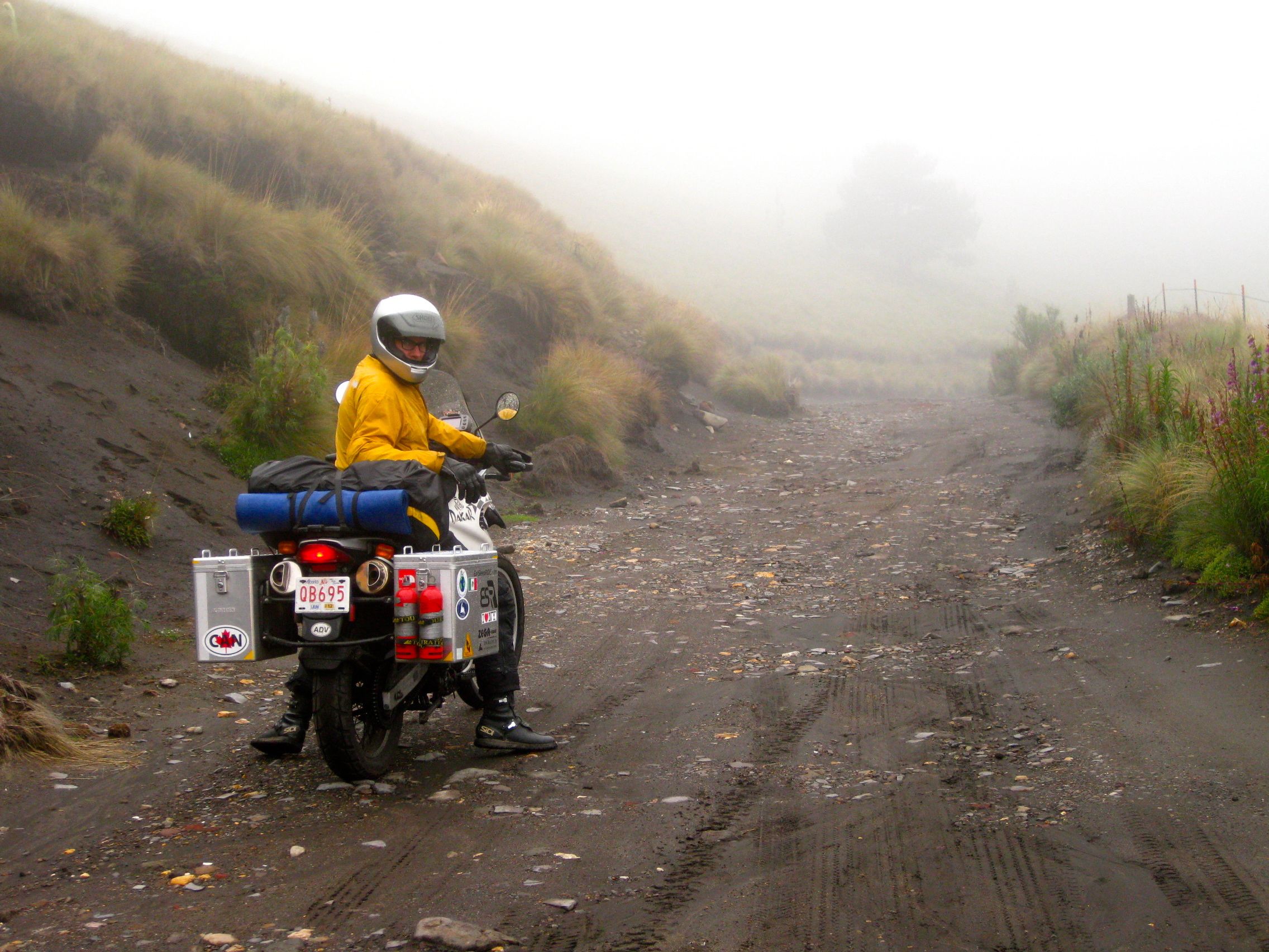
Slippery when wet
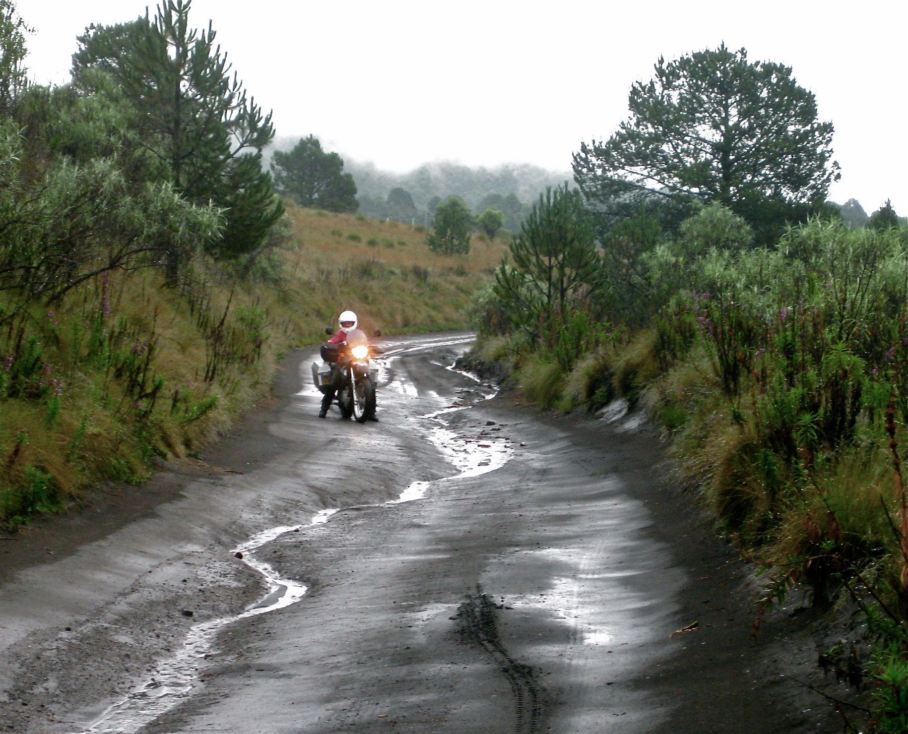
I wasn't immediately glad that he had. The next 7km were on road remenents overtaken with wet, slippery mud and washouts. It was also raining and foggy and our visors were misting up. I've never been shy to say that this is a learn-as-you-go trip for me. I had ridden my motorbike a maximum of 6,000kms before taking on this trip and, sliding around in mucky ruts was something totally new and somewhat scary to me. It wasn't long (1km, maybe?) before I said to JP that I was not sure I could make it and that it was well beyond my skill level. We chatted a bit about the situation and about not wanting to miss the opportunity that awaited us. In the end it was the thought of having to turn my bike around in that slop that ultimately convinced me to give it a go. In short, Jordan talked me off of the ledge - teamwork!
Thankfully, the mud subsided a bit and, although the road remained very steep and full of deep, slippery ruts, it was actually quite do-able. It was slow going, though as there was quite a lot of route negotiating to ensure I kept_away_ from the deeper mud. After a while the road turned into muddy gravel (quite grippy, really), then large, random rocks, and finally a very rough cobble - the kind with gaping holes missing all over the place. And it continued to get steeper and steeper… but no one dropped a bike and we both felt like we accomplished something after that ride.
The road improves, for a while at least...
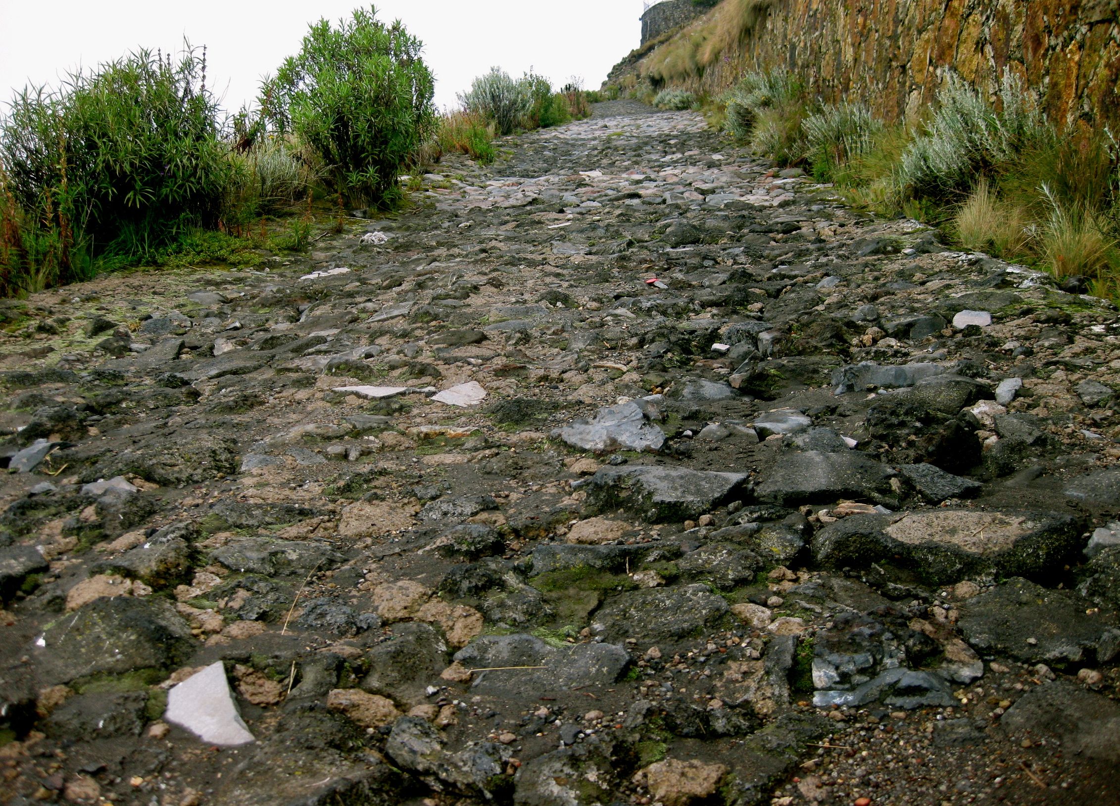
... before going all to hell again.
A massive electrical generator, radio & microwave towers, secured behind 8ft high metal fences, greeted us at the top. On our side of the metal fence was what looked to be a desereted soviet-era concrete bunker. The black, metal door to 'the bunker' was locked and we could hear faint and fuzzy conversations in the air - probably from walkie-talkie type devices located in the radio towers, but it reminded me of the opening scene of Contact. It was all kind of creepy. There was a Jetta parked in front of the big fences, so we banged on the metal door, hoping someone would answer to avoid a ride back down to the swinging-gate guy armed with a dictionary.
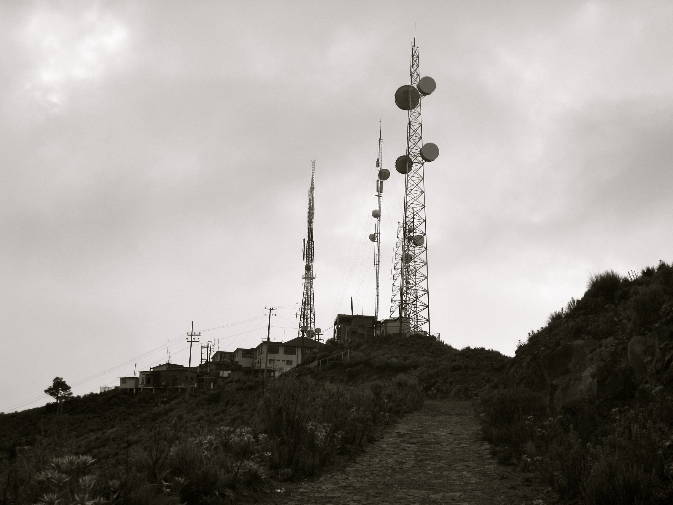
Just a few of the many towers at the top of our mountain
Yay for the only two other people who would ride up this slop during the rainy season to stay in a bunker! We had the right place, afterall. And, they did have a key - apparently, the only one available.
The bunker has 3 rooms - each with 4 metal bunk beds, a non-operational fireplace and a picnic table. The building has electricity, but no running water 6 giant barrels of water are there for a 'bucket-flush' system for the 2 bathrooms. So, if you go - remember to bring your own bedding and a supply of potable water. I should also mention that it was our anniversary, and although the bunker offered its own kind of charm, I would not really call it romantic (I only take Jordan to the best places!).
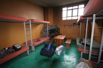
Our room, not sure why the luggage is floating
Daniel & Diego had their room and we picked ours. We set up our beds, brought in our kitchen from my panniers then went outside to admire the views and chat with our neighbours.
We explored as much as we could of the park when it wasn't raining. We would have liked to hike up Izta about 1km or so to get better views of Mexico city, but the weather was not cooperating. We only have our light hiking gear with us, so we stuck to the 4,000m level at the base of the volcano and walked the many trails throughout the park.
The 'sleeping lady' and some fun roads
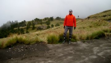
Hiking in our motorcycle boots to keep dry
It was also quite cold at night as the bunker was not heated. For sleeping we each wore a wool, long sleeved undershirt, a thermal sweater, a fleece neck- warmer, long johns, a light down jacket, a balaclava and ski socks. This was in addition to our silk sleeping bag liners and our sleeping bags. The piece de resistance was making an extra layer by using our motorcycle covers as a top blanket. Thus attired, we kept warm and had a couple of great sleeps in the mountains.
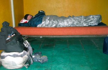
Keeping warm with what we've got - motorcycle covers
On our final morning, we were both suffering massive headaches, and had just 1/2 litre of water left for the two of us. We went outside to walk it off in fresh air, hoping for a cure. We were rewarded with a fantastic view of Popo, complete with plumes of steam escaping through the top vent. We ate oranges and tomatoes hoping the juices would help (we thought were dehydrated or at the mercy of the altitude - either way, water helps). Diego and Daniel had left while we were walking about and left their remaining litre of water behind for us. Thanks, guys! We drank the water, took a few more Advils and started packing up.
The 'smoking man' steaming from the top
The park is not new, but it is quite undeveloped and simple. By that, I mean the roads and parking lots are not paved and there are no facilities for park visters. There are no coffee shops or restaraunts in the area, though we did see a dry toilet at the Izta trail head along with a couple abandoned taco or torta huts (winter is the high season for the park, I'm sure someone works these stands then). There are no trail maps for the area… try looking for any information at all regarding this park - aside from some blog entries, there is only a very basic site that the Park hosts.
In Canada, having an active volcano in a National Park would have us stomping all over each other to hop in a gondola to get a good look (think of Banff's Sulpher Mountain, if you've ever been there). While at first I was irritated with the road conditions up to the hut and couldn't believe a government-run system would allow the infrastructue to fall in to such a state of disrepair, I took it all back. The hiking trails are great and there is a lot of ecosystem restoration efforts in the park. It was great that the area was not overly developed, and we enjoyed being one of only 4 people in the entire area.
Some park shots & a few riding videos:
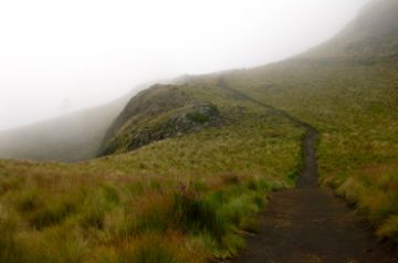
Hiking trails in the clouds
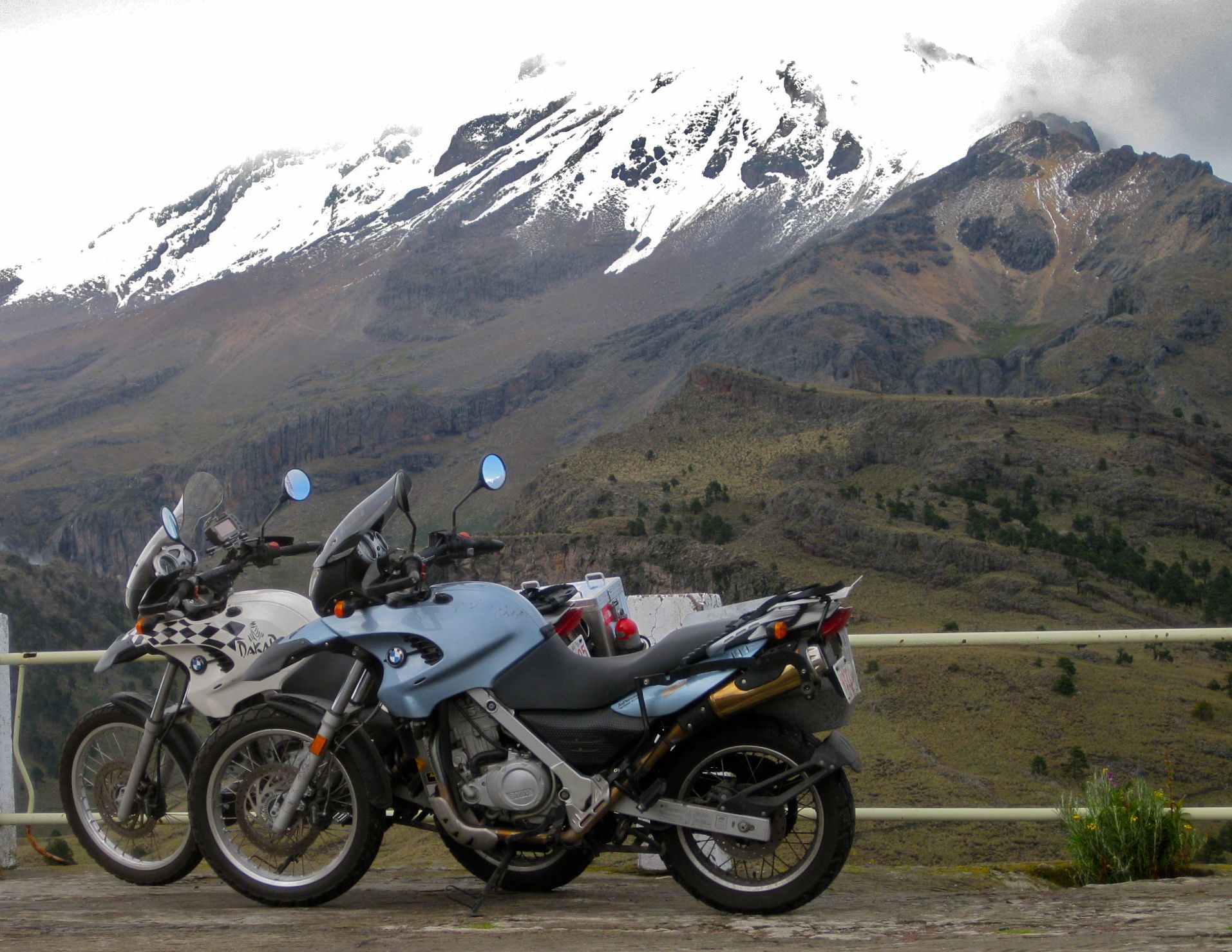
Mandatory bike - volcano shot
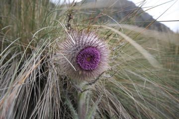
Not sure what it is, but we like it
Ride down from Altzomoni Hut
Road to Passo de Cortes