Niagara Parkway "tour"
I can be accused of playing tour guide. But I can't help it.
There are many interesting items in the Niagara area - from historical events to natural sights. Even a casino or two. The falls themselves are a major attraction - with good reason.
The trip starts from the south at Fort Erie, ON. This is the mouth of the Niagara River (which makes me ask myself what the other end is called...?) where water flowing from Lake Erie flows northward to Lake Ontario and eventually out the St Lawrence River to the Atlantic Ocean.
Across the river is Buffalo, New York USA. It's kind of odd to look across the small expanse of water and think "that's a completely different country over there... just a few yards away...". However the current here is very strong and in fact the river is dotted with ice floes broken loose from Lake Superior and passing through Lake Huron and Lake Erie to get this far - and still not melted! The Great Lakes are going to be cooooold long into summer this year!
.jpg)
Parkway Gate.jpg

Parkway Entrance.jpg

Peace Bridge Ft Erie.jpg

Pace Bridge Niagara River.jpg
Once northbound, following lazy turns, the river widens and slows and some people are out fishing - even in boats on the river. Some people are so fanatical about their sports, I guess (ahem!)
.jpg)
Fishing at the marina.jpg
As the parkway winds along, there are a mixture of old houses, generations old and new monstrosities (and some modern architecture thrown in...) on one side and the river on the other. There is a bike/walking path that parallels the road leaving the road relatively free of slow-moving traffic. The Canada geese are another issue entirely... although they are nesting this time of year, preparing to bear young.
One of the nice things, I think, is that nearly the whole riverside is one big park - you can pull off and have a picnic nearly anywhere along the river. (Watch out for goose poop)
The "south" portion of the parkway, from Niagara Falls to Ft Erie is usually less traveled than the "north" portion which is more "touristy".

Niagara Parkway northbound.jpg

Houses along Niagara Parkway.jpg

Home on Niagara Pkwy.jpg

Modern home on Niagara Parkway.jpg

starter home.jpg
(for those of you "from away", these are monstrous and expensive - because of the location (riverview) - homes)
Approaching Niagara Falls from the south, the mist from the falls hangs like an ever-present fog on the skyline.

Niagara Falls ON from south2.jpg
But first, the parkway passes through the section of town called Chippewa - where there is a popular Tim Horton's donut and coffee shop with a parking lot full of cliche motorcycles. Tim Hortons are everywhere in Canada (Ontario especially) and and weekends the parking lots are usually crowded with motorcycles - for those who consider Tim's a destination and are into talking more than riding... however a good place for a rest stop and a warm up on a cool day..

Familar sight Tim Hortons parking lot.jpg

In Tim Hortons line.jpg
Onward into Niagara Falls proper and on any day, but nice days especially, summer or winter, there are literally thousands of people. From everywhere. Almost every nationality and culture is represented annually - or more frequently. It is definitely a "must see" for visitors and it is possible to just stare and drink it all in for hours (if you could stop that long). The cascading water, the roar, the mist, the rainbow, the rocks, the deep chasm - it is all mesmerizing.
The falls are made up of two falls - the straight "American Falls" and the curved "Horseshoe Falls" (which is the one everyone thinks of when they think of Niagara).

Rainbow Niagara Falls.jpg

American Falls.jpg

Horseshoe Falls.jpg

American and Horseshoe Falls.jpg
I think the signs above the falls that warn of danger due to "sudden changes in water level" are hilarious. The drop is 165 feet (50 m) according to Wikipedia over the falls is certainly dangerous....
http://en.wikipedia.org/wiki/Niagara_Falls
But I think what the signs are referring to are the changes in the flow as water is diverted to reservoirs for the various hydro-electric power stations further along the gorge.
The Rainbow bridge links Niagara Falls ON with Niagara Falls, New York.

Rainbow Bridge Niagara Falls.jpg
Now instead of riding along the river's edge, you ride along a cliff edge. Next stop is the Whirlpool.
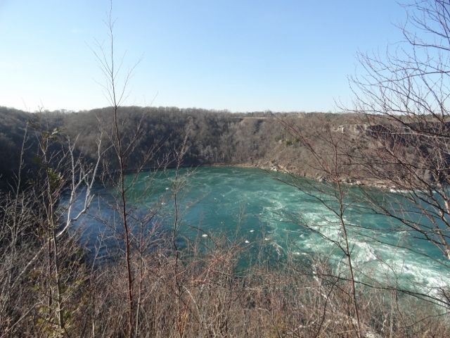
The Whirlpool is like a growth out of the river's route. The water seems to boil and surge and this is where swimmers drown, more so than going over the falls. It is said that bodies in the whirlpool can stay under for days. From the edge of the gorge, ice and even tree trunks can be seen caught in the swirling water.
And someone thought this was an "ideal" place to string a cable car across...
Whirlpool.jpg

Whirlpool cable car 3.jpg

Whirlpool cable car.jpg

cable car close up.jpg

Rana patiently waiting.jpg
Next along the gorge is the hydro stations..

American hydro plant.jpg

Sir Adam Beck hydro plant 2.jpg

Queenston-Lewiston Bridge.jpg
And the third Canada-US border bridge, the Queenston-Lewiston Bridge.
Queenston and its Heights are the proper start of the Niagara Escarpment (you can read the plaque...)

Escarpment plaque.jpg
Queenston Heights was the location of an early battle between the US and Canada in 1812. (in fact the whole riverside or "Niagara Frontier" was a battle zone) As far as world history goes, the "War of 1812" was a mere border skirmish compared to the European Napoleonic wars of the time. However, it was a big deal here...

Rana at the Brock Monument.jpg

Rana at Brock Monument 2.jpg

Niagara River from Queenston Heights.jpg

Birthplace of the Falls plaque.jpg
From Queenston the parkway winds again amidst Victorian-styled estates, and picturesque farms. The Niagara region is Ontario's "fruit basket" and grapes and wineries are very popular - you can't throw a rock without hitting one...
The Parkway finally ends in Niagara on the Lake - very touristy and post-card- like. It is home to the Shaw (George Bernard) Festival - live theatre - which is well worth attending.
1800's British garrison, Fort George, is a must for history buffs...

Parkway entering Niagara on the Lake.jpg

Clock NotL.jpg

NotL main drag.jpg

Fort George NotL.jpg

Boom NotL.jpg
There lots to see and do along this route - so plan to do it several times!
Cheers!
You must be logged in to comment
Login now
121 months ago
@alex well it was pretty leisurely pace... @romancylkowski Thanks! Yes I'll update photos in the summer... right now you can see what you'll miss in June, because of all the leaves...
121 months ago
@romancylkowski, thanks for sharing this ride, photos together with your write up immersed me into the beauty of this area. Would be great to see photos from there mid summer!Â
122 months ago
With all these pictures, I can only assume this was a full-week trip?
122 months ago
Who is June and why are we waiting for her?
122 months ago
Thanks @Stw8s ! The good and bad about the route this time of year is the lack of foliage. Good because the views aren't blocked but not so good for lush greenery in the views. Just wait til June!
122 months ago
One of my favorite routes! Thanks for the great write up.
122 months ago
I'll have to do the reverse route from the American side...
122 months ago
@JimmyTan thanks! I feel the same when I see your pics and tales... You've posted a lot of great stuff recently and due to being away from my internet connection (due to house moving) I haven't had the time to comment yet (I will!)
I should have added that it is difficult to get the scale of the gorge and the falls. A good guide is the pic of the American Hydro station... on the right-hand edge you can see parked transport trucks (18-wheelers). Also there are cars driving across the top of the American Hydro plant too.
A good book on the history and characters that make up what Niagara is today is "Niagara: A History of the Falls" by Pierre Berton - an entertaining and informative read. http://www.amazon.ca/Niagara-History-Falls-Pierre-Berton/dp/038565930X/ref=sr_1_1?s=books&ie=UTF8&qid=1398254655&sr=1-1&keywords=niagara+pierre+berton (available on Kindle!)
122 months ago
A nice write-up. Thanks for 'taking' me on a ride there. Perhaps, one day I'll be able to ride Canada and the US for a change 🙂