Riding the World Famous Cañón del Pato in Peru
Chuquicara to Caraz, Peru
So, you are in northern Peru and need a change from the barren desert scape you've been riding for days. You are looking for an off road challenge, and some extreme scenery away from traffic and you want to avoid any other people at all costs. Welcome to the Cañon del Pato!
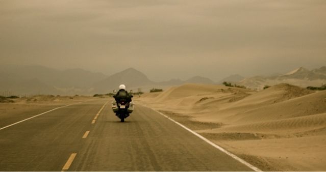
multi-day desert scape
From north to south, the ride starts in Santa, Peru about 12km north of Chimbote. But, whatever you do DO NOT ride through Chimbote. It is, quite possibly, Peru's most offensive city from an olfactory perspective thanks to its giant fish meal plant… it is the only time in the last 8 months we thought we might throw up in our helmets - and we've ridden past more than our share of steaming garbage and rotting road kill. Instead, approach Santa from the north, if possible.
The initial 50 km are along a small, quiet paved road in excellent condition. As you move away from the coast, sand dunes turn to dry, dusty hills covered in cacti and other prickly looking plant life. The road parallels the Rio Santa, turbulent and milky brown as cuts its way through the rock from the Andes to irrigate the dry west coast. A few small villages dot the road and if you need something to drink or are looking for almuerzo (typical Peruvian lunch of soup, & roast chicken with rice) you will have no trouble finding it. Our stop was in the roadside town of Chuqicara where the pavement abruptly ends.
Since we also arrived late in the day we decided to stay for the night and tackle the canyon the following day - the canyon section is about 100 km on a narrow gravel road and we knew it would take us more than the 3 ½ hours of daylight left. There are no official accommodations in Chuquicara but at the western edge of town (located less than 1km from the eastern edge of town), there is a police check point and the officer on duty allowed us to pitch our tent beside his office for the night - we've also heard of other people sleeping in the town gas station or in the police barracks itself but, we set up in a small gravel lot between the police station and a restaurant… convenient & safe, if not pretty.
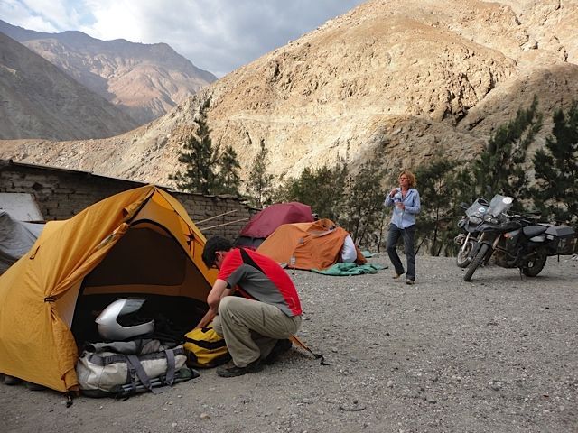
Camping in a parking lot
It's best to check your fuel before heading out because, although there is a gas station in Chuqicara, they had no gasoline when we were there and the gas station owner did not know when he would be getting more. Our tanks were well under half full which was enough to see us to Yuramarca (where we were assured there would be gas) however, our riding partners had brimmed their tanks in Santa, so they could share if push came to shove.
The pavement ended abruptly in Chuqicara and, as always, that is where the real adventure began. The road cuts its way though the Santa Valley, hugging a sliver of land between the river and the steep valley wall. Riding the rough gravel through the canyon was very hot and dusty and, at points, got so narrow that there was only enough space for one-way traffic. This can mean stopping to wait for trucks to pass from time to time (trucks always have the right of way) but, to be honest, there was not a lot of traffic to deal with. The route had some tricky bits but, for the most part, was quite manageable with hard packed gravel. The occasional deep and/or slippery sections kept us on our toes.
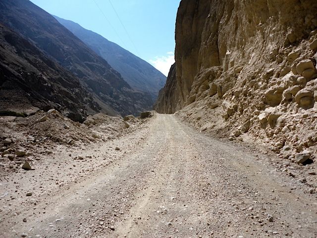
Where the pavement ends
Stunning views and very cool rock formations are part of what makes this route so famous. The scenery was absolutely gob-smacking. We took it in and took it slowly, stopping a number of times for water, snacks, numerous photos, and any other reason to make this a full-day event.

Fellow Calgarian, Jay and his pillion, Eric
5909 .jpeg]
One of the more exciting, though unplanned, breaks was at a particularly narrow section where the road suddenly became almost impassable. For the most part the canyon road was dry as a bone, except for this small section clogged with deep, wet mud (we rode through in January - the rainy season in the mountain ranges which feed the Rio Santa). Previous truck and bus traffic had churned the mud into a sticky gumbo with deep ruts making it even more interesting. We approached to see 3 cars in various degrees of trouble needing assistance. We obliged and helped to push them out of the 200 meter stretch while trying to hold back an impatient bus driver intent on keeping his schedule regardless of what (or who) was in front of him.
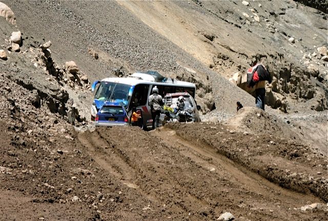
Another impatient bus driver
Getting four bikes through took a lot less effort, but proved much more exciting. One of the bikes needed to be pushed, but we were able to plough through with the others, bash plates dragging through the mire along the way. It is always fun getting the bikes to look like proper adventure tourers, covered in mud.
Getting through the mud
More good gravel continued as the road gradually gained altitude while taking us though several rough, hand hewn tunnels and past what appeared to be a small coal mine of sorts. After passing some dusty remnants of towns-gone-by we began a more aggressive climb to Yuaramarca, the unofficial ½ way point. Steep switchbacks provided more stunning views of the Santa Valley along the way.
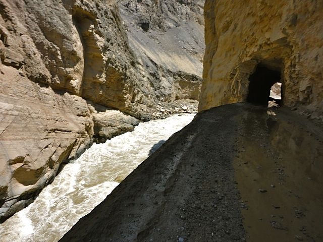
Hand-hewn tunnels
5919 .jpeg]
We arrived in Yuramarca with our fuel lights blazing and were able to replenish the bikes' fuel supply from a woman selling gasoline out of 40 gallon barrels and a old metal watering can. A quick look around showed there were a few restaurants and even a hostel or 2 in the small village if you were so inclined to spend the night. We didn't hang around, though - instead, we stopped a few kilometres further on for a quick roadside picnic.
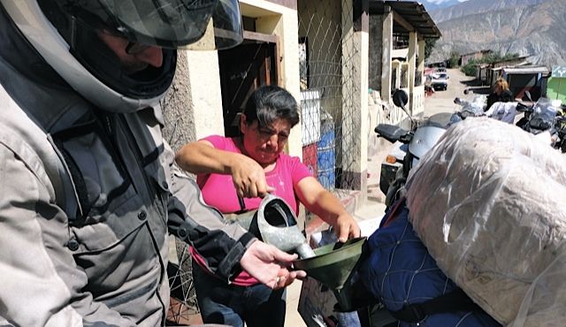
Full Service gas station in Peru
After dropping some altitude, we were able to pick up speed. The road levelled out and remained straight, wide and well packed (read: easy to ride) as it hugged the east side of the valley wall, high above the river. A bridge at the end of the stretch would carry us to the other side of the valley over a deep gorge of rushing water. If we all made it across, that is. Nothing is for sure in South America… least of which are the conditions of bridges, so dropping guard is ill advised - even on a 'good stretch'. On her way across the sturdy, but uneven bridge base, one of our team members' front tire rubbed a loose and ill-placed plank which caused a short slide - luckily stopped by the metal railings lining sides the bridge that overlooked a raging river in a huge gorge. Her bike faired better than her pride, losing some body work, the break lever and a bolt holding together part of the front fairing.
In the true spirit of the Dakar Rally (which was somewhere in Peru at that exact moment), we performed a little roadside repair and were on our way again.
After the bridge and some more climbing we approached the final 35 km in the valley and entered the Cañon del Pato, proper. Carved by a river where the Peruvian Andes' Cordillera Negra (forming the eastern ridge) meets the Cordillera Blanca (forming the western ridge), the canyon is impossibly steep and narrow. On average, the distance between the two ridges (crest to crest) is just 16km1 but at its narrowest, just 6 meters make up the canyon floor where the river now flows.
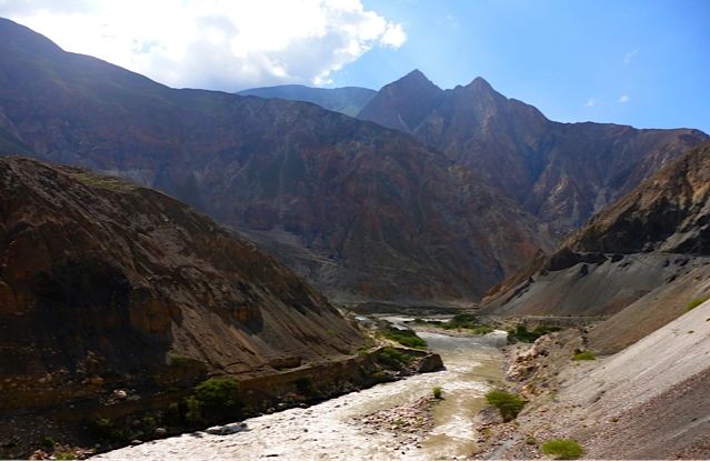
More great scenery
For riders, though, the best part of this section of the canyon is the 35 one- lane tunnels that you must negotiate in order to break free of the canyon on the other side. Light traffic meant we only had to pull over a few times for cars and busses, and not once did we encounter an oncoming vehicle in the middle of a tunnel, though this is not unheard of! We were thrilled at this stroke of luck because we've found Peru to have the most aggressive and impatient drivers in all of South America.
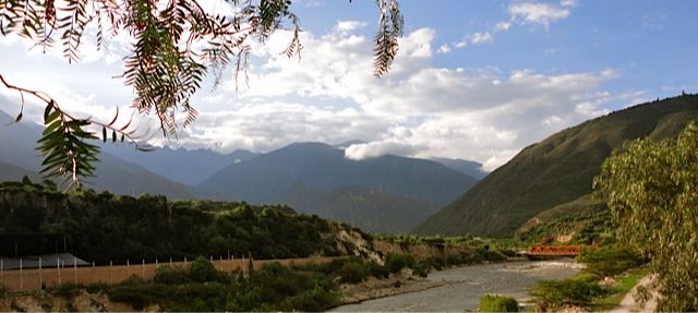
After leaving the canyon, riders are yet again rewarded for their efforts by a newly paved load that winds and twists its way to the charming town of Caraz. At 2,250m, Caraz is popular with the hiking and climbing crowd and, because it is one of the only towns spared in the area's devastating earthquake of 1970, it maintains the architecture of a traditional Andean village.
Looking back having left the canyon
As far as accommodations are concerned, there was no shortage of places to choose from in Caraz. We found a nice and cheap hostel on the main square, parked our bikes in the courtyard, found a popular local restaurant and enjoyed a large and much deserved beer.
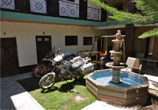
Parking in our Caraz hotel
GoPro Video:
Riding the Canon del Pato - Peru
Category: Dual-sport
Trip details: Chuquicara to Caraz, Peru (north to south):
- Santa, Peru to Chiquicara: ~ 50 km on paved road.
- Chiquicara to Yuramarca (1,420m): ~ 78 km gravel road (gas, hotels & restaurants in Yuramarca)
- Yuramarca to Caraz (2,290m) - 52 km (30km gravel & 22 km tarmac)
Hotel in Caraz: San Marco Hotel (S/ 20 for a double w/ shared bath). Located on the Plaza de Aramas