Wildfire Near California Highway 1
Lompoc, California, United States
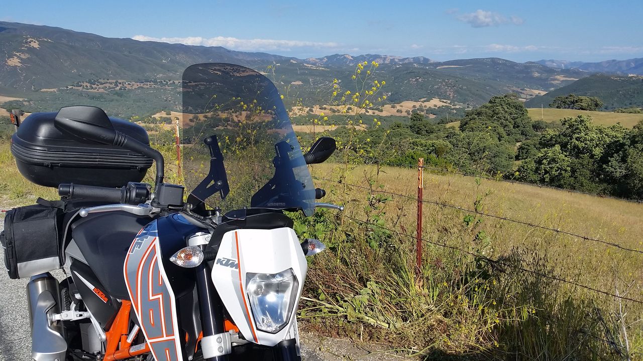
The view from Carmel Valley Road last year. I hope this area is not too badly burned.
By Andrew Kohn
About a month ago as I was testing the Victory Octane for ESR, I had to cut my ride short due to a family emergency. On the second full weekend of the test, I was going to take the bike up the iconic California Coast to Big Sur and was going to post my impressions. Unfortunately, I never had the chance to take the Octane up the coast.
Now that things have settled down at home, I thought I'd ride my own bike up the coast and post a cool ride report. Well, the fire gods were conspiring against me last weekend, as the area near Big Sur is on fire!
The fire is called the Soberanes fire and it has burned over 40,000 acres, destroyed 57 homes and is only 18% contained according to Cal Fire. Four years of drought conditions have made our part of California bone dry and susceptible to large wild fires. As you can see from the map, some of California's best motorcycle riding is near the affected area. Though Highway 1 is still open, the skies are hazy, the air quality is poor, and most of the parks and campgrounds in the area are closed.
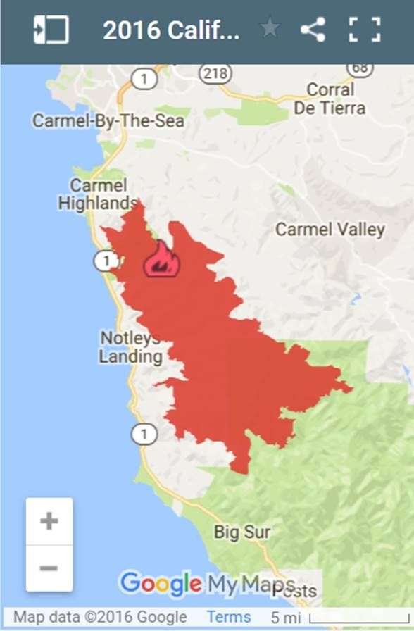
Soberanes Fire (from the Cal Fire website)
I'll try to post the ride report in the next couple of weeks after the fire comes under control. More information about the fire can be found here: cdfdata.fire.ca.gov/incidents/incidents_details_info?incident_id=1348