Ohio State Route 800 - Hills, Curves and a River Ferry
Distance: 142.9 Km / 89.1 Mi Duration: 02:03:51
One fact about the eastern Ohio landscape is that the terrain gets more varied and the roads more fun the further south you go. This is thanks to the way the glaciers of the Laurentide Ice Sheet carved the land up about 18,000 years ago.
Of course, one of the great ways to explore this geographical transition from the flatter lands of northeast Ohio to the Appalachian hills of the southeast is through Ohio State Route 800.
This 90 mile route starts in Dover, Ohio, and snakes a twisty path parallel to Interstate 77, crossing I-70, and eventually ends at Fly, Ohio on the Ohio River and West Virginia border.
Along the route, you'll find plenty of scenary and more than enough twists, sweepers, hills and valleys to keep the trip entertaining.
The route can be a destination itself, but it's an excellent way to transport yourself to even more of southern Ohio's great roads, like 26, 536 and 255. It also crosses the "Backbone of Ohio's Dragons", route 78, which leads to even more adventures.
From Dover down through I-70, the road's challenges are pretty open to nearly all skill-levels, though you'll want to still watch for unexpected road hazards like animals hidden by blind curves. Fortunately, you'll also more small towns to stop, rest or eat in the northern part of the route
As the road travels south from I-70, it becomes much more technical. From Woodsfield to the end at Fly, Ohio, you'll be greeted by everything the road can throw at you, sometimes all at once.
Definitely pay attention to the road ahead as some of the curves could be better marked in this final stretch.
Once you are at the end, however, take the time to visit one of my favorite little attactions on the southereast Ohio border. The Sisterville Ferry helps vehicles cross the Ohio River from Fly, Ohio to Sisterville, West Virginia. It's one of the last ferries still running the Ohio River, and makes for some great photos with your motorcycle.
Weather conditions can effect ferry service, which normally runs from 9am to 6pm, so check their Facebook page to confirm their daily crossing information. Cost for passage is normally $4 for cars, $3 for motorcycles.
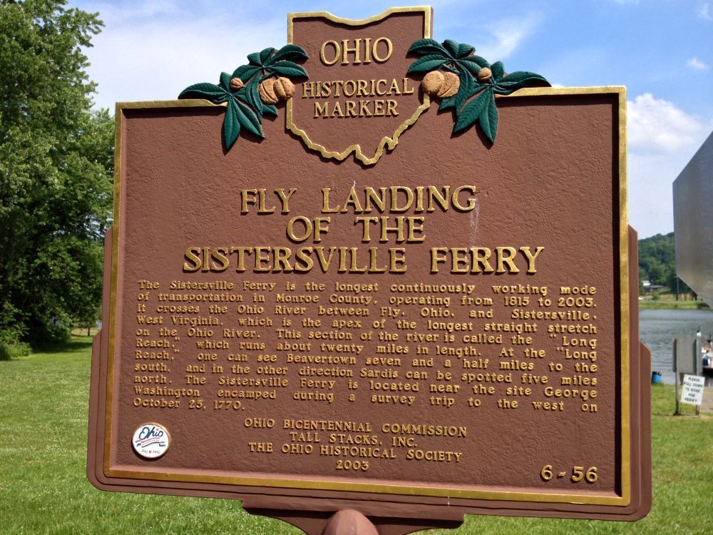
Fly Landing of the Sisterville Ferry
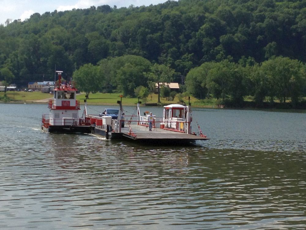
Sisterville Ferry coming in to dock
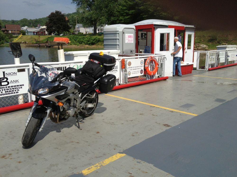
Motorcycle Crossing by Ferry
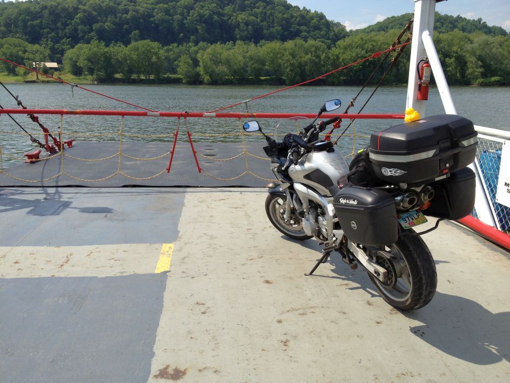
Motorcycle Crossing by Ferry
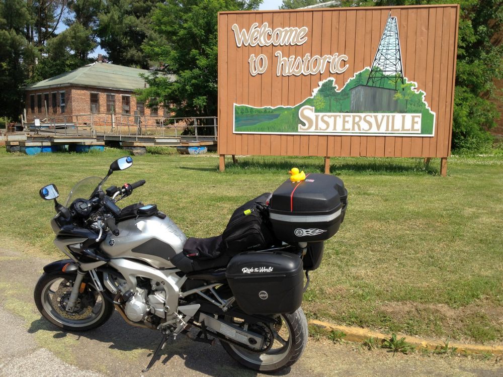
Welcome to Sisterville, West Virginia
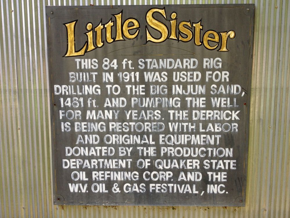
Little Sister
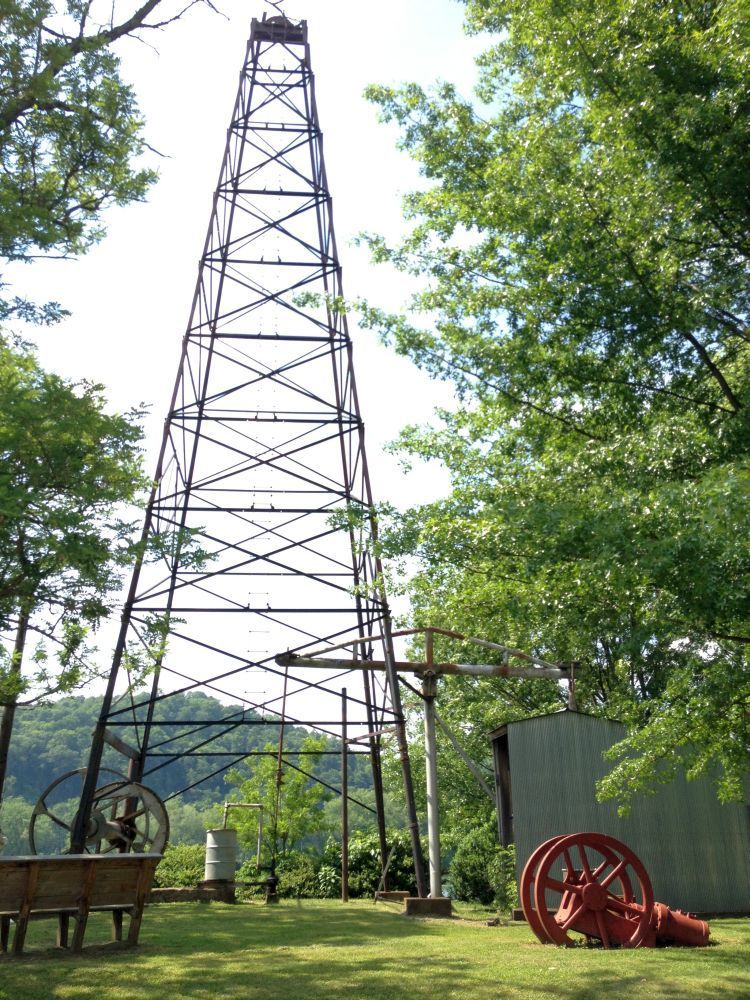
Little Sister Oil Derrick
[cid=38422,https://i.embed.ly/1/image?url=http%3A%2F%2Fi1.ytimg.com%2Fvi%2FDLPkSu9AVSc%2Fhqdefault.jpg&key=516300eb362841bdadceffb501cc9537]
[cid=38423,https://i.embed.ly/1/image?url=http%3A%2F%2Fi1.ytimg.com%2Fvi%2F2Oc9ivcp_yY%2Fhqdefault.jpg&key=516300eb362841bdadceffb501cc9537]
You must be logged in to comment
Login now